

Manoj Sahu: An Astounding Traveler from Odisha
Showing posts with label Travel Photographs. Show all posts
Showing posts with label Travel Photographs. Show all posts
Saturday, October 20, 2018

Thursday, May 11, 2017
A Travel trip to NeerMahal at Melaghar Tourist Circuit, South Tripura.
 A Day Dream: Visiting The Water Palace "Neermahal":

Hello dear, A lot of many people love to travel and experience the taste of new place, new atmosphere, new environment and they finally says Woahh the...Melaghar NEERMAHAL.
A trip to NEERMAHAL in Melaghar Tourist circuit of southwest Tripura is indeed while you are plan to travel for Tripura State.This is Only such a palace around the water by of Rudra Sagar, in Sipahijala District of TRIPURA State. In India this the 2nd Jalmahal/Neermahal after Jalmahal in Rajasthan.
This royal palace[Water palace inside waterbody] was built by King Bir Bikram Kishore Manikya Bahadur of the erstwhile Kingdom of Tripura,India in the middle of the lake Rudrasagar.
Saturday, November 12, 2016
Speak less tells More PART-1 NDEBC May-2013
These are some Memorable clicks, which were taken during my NANDADEVI EAST BASE CAMP Expedition on May-2013 with STEP TREKKERS [www.steptrekkers.org].
The expedition experience will noted down later with photo story.

The expedition experience will noted down later with photo story.

Sunday, October 5, 2014
Odisha Tribal Tour 2014
|
A short brief Description
about the program
This TRIBAL
TOUR Concept is completely difference in comparing to Other Adventure
programs even trekking, cycling, river rafting, hiking, traveling etc. We
the www.steptrekkers.org for the first time maiden our trek program
in Odisha as “Coastal trek cum Heritage tour” on last Feb-2014, After its
grand success again we planned for this “Odisha tribal tour-2014”during Just
post monsoon of 2014.This Concept of tour has its Own Charm. The Narration
of tribal Beauties Never be End, The Major portion of the tribal habitat is
on Hilly and Forest Areas, Where about 65% of the land in Odisha covered with
forests and about 64 tribes were founded in Odisha itself Out of which 437
tribes of India. Above all the tribal villages are generally found in Areas
away from the alluvial plains which are close to the river Area's. All these
tribal Area's were found in between 1750 ft to 4800 ft above from the sea
level. Most of the villages are monoethnic in composition, and smaller in
size. Some Villages are often riot planned at all. Most of the villages
fairs, Haat area's were strictly prohibited for photography. As this tour follows with a series of sloppy
Green valleys, Parallel High hill landscapes, Dazzling streams, fountains,
waterfalls, Tribal Music’s, Green Carpet of Paddy fields, Dams, Lakes,
Hydro-electricity power projects, Hanging Bridge, temples, Old Palaces,
Industrial Urbanisation flavours with tribal spirit had defused the
participants Whose were finally taken another Oath as “Manoj Sir, Once More such a tour Again with some
different route with Other tribal Spirit in Odisha”.
 |
Monday, April 22, 2013
Pictures from wonderful Nagaland of India and some tourist information
 |
| A Naga people During Hornbill festival-2011 |
My Ist time Visit to this Wornderland [NAGALAND], Was Quite impressive,Whenever I'd went to Mizoram for Taken participate as a participant in YHAI's MZNTCE-11 Program, During my return Trip I'd tried to attempt at least Once for a 3day Break trip journey before reached to my Home town Chatrapur[Odisha].
Truelly this One an amazing land On the North east region of Indian Peninsula. It is a mountainous country with a tropical climate, when in the summer a man is cooked in his own juices and fans in the rooms do not stop. In winter, you can finally enjoy a bearable temperature. We were there at the turn of December and January – during the day we were running around in T-shirts and flip- flops, but in the evening, at night and the next morning we had to put on a lot of clothes.
Monday, March 25, 2013
Trek to Kumaraparvata-2013 [Dakshina Kannada], Karnataka, India
(My trekking On South India's TOUGHEST Peak Kumaraparvata with family)
 |
| Me with my family and trekmate Mr. Shambhuprasad from Bangalore |
Biggest draw to the trek is difficulty level of the route and the freedom to pitch the tent at the top (I mean, literally at the very top). Trek to Kumara Parvatha(to Pushpagiri Temple) is considered to be one of the most challenging treks in Karnataka. There are two approaches to the Pushpagiri temple, one from Beedahalli(7kms – Kodagu district) and other one from Kukke Subramanya(14kms – Dakshina Kannada[DK] district). Generally, one side is the approach route and the other side is the descent route, based on ones choice.
Thursday, December 6, 2012
My Amarkantak and Jabalpur Trek On 2010

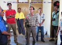
Really it’s an unique concepts of an adventure treks which one organized by the direct involvements of the skilled trekkers of YHAI’s Jabalpur unit in MP state. Where YHAI provides all night camping equipments and given up-right to all participants who will fix scheduled activities and works accordingly the guidance of the organizers. Here a detailed chart how did we starts and close’s successfully our treks. Actually this trek began as we just finished our reporting on a scheduled time. Programs start on 25th oct2010 and ends on 31st oct2010.
1st Day, 25.10.2010, Monday; advised to report at Jabalpur YH & sightseeing tour
 |
 As all 47 participants are finished to report at Jabalpur youth hostel near Ranital Stadium by 08.00hr, organizer’s were arranged tazzaa tazzaa purie, sooji kaa uppmaa & sabzee with bhindi aloo curry, jeelleebiee, fried rice & a lots for us as breakfast & pack lunch. By 10.30am everything was ready including demonstration of tent pitching training by vishalji (sect), a short introduction about the history of evolution Madhya Pradesh & Jabalpur City by sampad basu dada( chairman), total trek group leads pilot Mr. Sanjay Yadavji & even co-lecturer by hiramathji.
The bus had leave by 10.45am after a well blessed symbolic style (lal tilak) impression by Vishalji to all trekkers inside the bus. Actually the bus journey is meant for local sightseeing at Jabalpur. Before the journey flagship our YHAI Jabalpur unit chairman Mr. Sampad Basu told about the Jabalpur is an ancient and historical city of temples, pilgrims, marble rocks and enchanting waterfalls, which has referenced about the mythological epics of our legendary volume RAMAYANA. It was also the center point of Hayhaya dynasty and also the capital of Gond Kingdoms during the 12th century. Jabalpur also later ruled by the Kalchuri Kingdom. Still today most of unknown about the center points of India. Actually the centre point of india is situated at the Manohar gram near karondi at a approximately 63km distance from Jabalpur.
Saturday, March 17, 2012
Recharging Memories with Sanjay, While In & Off Shore at Narmada near Jabalpur
A surprise visit to Jabalpur on March 2012 before departs
for Everest Base Camp on April 2012. During this time Sanjay Yadav and I
re-discovered some sites as we jointly visited during our last trek to
Amarkantak and Jabalpur on October 2010.
On this trip we had covered Gandhi Memorial at Tilwara Ghat, Guwari Ghat,
Gurudwara, Lameta Ghat, Bhera Ghat, Marble Rocks, Chausathi Yogini Temple, Madan Mahal Fort, Jain Temple, Tortoise Rock etc.
For further places of attraction will found on below link:
 |
| ना जाने कब मेरा नंबर आएगा...!!! |
My Trip to Amarkantak & Jabalpur on March-2012
 Amarkantak may not be one of the most popular tourist destinations of India but to those who know Indian culture and tradition is well aware of the fact that it is one of the most sacred pilgrimage destinations of the Hindus. Popularly known as “Teerthraj” (the king of pilgrimages), Amarkantak is deemed to be the door-way to “Nirvana”. Apart from being a sacred pilgrimage destination, Amarkantak with its verdant hills, forested surroundings and breathtakingly beautiful waterfalls has all the ingredients for a memorable tour in the midst of nature. This great-unexplored tourism destination of Madhya Pradesh is a place worth a visit.....// Must see It.
A Surprise Journey to Amarkantak and Jabalpur from 13th March to 16th March 2012, It self sufficient to re-enforcing the depth of catchment as ''Amarkantak – king of pilgrimages in India''. The Holy places like Amarkantak – king of pilgrimages in India Shiva temple, Kartikey temple, Shri Ram Janki temple, Annapurna temple, Guru Gorakhnath temple, Sri Shuryanarayan temple, Vangeshwar Mahadev temple, Durga temple, Shiva Pariwar, Siddheswar Mahadev temple, Sri Radha Krishna temple, Eleven Rudra temple etc. Even Sonemuda,Kapildhara, Kapileshwar Temple, Dudhdhara, Kabir Chabutra, Mai Ki Bagiya, Jwaleshwar Temple etc re-echoing to me time to time,... So have a refresh.
Wednesday, June 1, 2011
My Trip to Bhima Devi Temple & Pinjore Garden Near Panchakula
Mostly known as Pinjore
Gardens, but it was Yadavindra garden. This Yadavindra Gardens are located
about 20km distance from Chandigarh towards the panchakula route on National
highway. The Pinjore Gardens were created in the 17th century on the foot-hills
of Shivalik Range. As per the Hindu mythology, it was the Mahabharata fame -
Pandav Brothers who resided in Pinjore during their exile. The Pinjore Gardens
have been made exactly at the place where the Pandavas resided. .The
construction of the Garden was done by Nawab Fidal Khan, architect to the
Mughal emperor Aurangzeb.
Covering an area of 100 acres, the Pinjore Garden is filled with abundance of grass and tree greenery. There are numerous fountains which add beauty to the garden.
Fast Facts
» Location - Pinjore-Kalka Road, 20 kms from Chandigarh, Pinjore, Haryana
» Approach- Bus Services, Cabs - Easily reachable by road.
» Best time - December to March end.
» Visit Timings* Summer - 09: 00a.m. to 01: 00 p.m. and 03:00 to 07:00 p.m.
Winters - 09: 00 a.m. to 01:00 p.m and 03:00 pm - 06:00 pm. (*Timings are subject to vary)
Covering an area of 100 acres, the Pinjore Garden is filled with abundance of grass and tree greenery. There are numerous fountains which add beauty to the garden.
Fast Facts
» Location - Pinjore-Kalka Road, 20 kms from Chandigarh, Pinjore, Haryana
» Approach- Bus Services, Cabs - Easily reachable by road.
» Best time - December to March end.
» Visit Timings* Summer - 09: 00a.m. to 01: 00 p.m. and 03:00 to 07:00 p.m.
Winters - 09: 00 a.m. to 01:00 p.m and 03:00 pm - 06:00 pm. (*Timings are subject to vary)

A Trip to Manali, Kullu & Naggaar Castle In Himanchal Pradesh
The most charming and
beautiful Kullu valley spreads out its charm on either side of river Beas. Kullu
was once known as Kulanthpitha, which means the end of the habitable world.
Beyond rose the forbidding heights of the Greater Himalayas and by the banks of
the shining river Beas, lay the fabled 'Silver Valley'. The valley runs north
to south of Beas river and is 80 km long and about 2kms wide.
This town is famous for its temples and the annual Dushera festival, both of which attract thousands of tourists. The town of Kullu has long been a centre of faith. In 17th century, Raja Jagat Singh installed here an idol of Lord Raghunathji, which he brought from Ayodhya. As a mark of his penance, he placed the idol on his throne and it became the presiding deity of the valley.
Kullu is located in the central part of the state of Himachal Pradesh, India. It is located at an altitude of 1200 m above sea level at the confluence of Beas and Sarvari rivers. It is 240 km north of Shimla.

Wednesday, May 25, 2011
Biskeri Top and Surpass Himalayan Trek on May 2011

All
Photos are legally protected; do not copy and use somewhere without
permission of this site owner. Enjoy reading & watching!
Biskeri Thatch Himalayan Trekking On 2011
.jpg)
All
Photos are legally protected; do not copy and use somewhere without
permission of this site owner. Enjoy reading & watching!
Tuesday, August 10, 2010
Lakhari Valley Wildlife Sanctuary, Ganjam (Near Taptapani Hot Spring)
Lakhari Valley Wildlife Sanctuary was not mapped and/or addressed by GoogleEarth so far; though it is best to locate this wildlife sanctuary by Taptapani, one of the famous hot springs in India. Taptapani is only 255 km by road from Bhubaneswar airport and 84 km by road from Brahmapur Railway Station. (See Road-map from Brahmapur and Bhubaneswar)
The Lakhari Valley Sanctuary is a dwelling place of a large number of elephants and blackbucks. The sanctuary is one of the most elephant populated sanctuaries in India. The other chief attraction of the sanctuary is the black buck, which is present in large numbers in the sanctuary. In addition to this one can see various species of animals like tiger, pea fowl, leopard and many more.
The Lakhari Valley Sanctuary is a dwelling place of a large number of elephants and blackbucks. The sanctuary is one of the most elephant populated sanctuaries in India. The other chief attraction of the sanctuary is the black buck, which is present in large numbers in the sanctuary. In addition to this one can see various species of animals like tiger, pea fowl, leopard and many more.
Where to stay?
One can stay at Panthanivas, Guest House of Odisha Tourism Development Corporation, OTDC at Taptapani or at Chandragiri or at Pudamari, Digapahandi and Mohana.

Tuesday, January 5, 2010
Manavaanoor Base Camp at Kodaikanal, Kerala
 |
| Location: India > Tamilnadu > Dindigul > Kodaikanal To Kerela > Munnar |
The permission should be obtained for a
trek from Berijam lake to Top Station. Berijam is a secluded lake about
24 kms from Kodai and special permission is required to enter place.
This permission too is available at the DFO office at 10 am everyday
(except Mondays and Tuesdays). In case the permission is not available
for Berijam, you might have to start your trek from Poondi village. At
the other end, Top Station is 34 kms from Munnar and is in Theni
district of TN. However, in the course of your trek, you would be
crossing into Kerala for sometime atleast.
The trek distance is 22 miles
or about 36 kms. The initial 20 kms would be on a wide jeep track which
is still in use. Diversions could be confusing. The first major one is
about 2 kms from Berijam where there are 3 roads intersecting - take the
right. Proceed further through beautiful Pine forest for another 4 kms
where you get a fork - a track to the right going downwards and one
straight on, in the same plane — Continue straight on. Another 4 kms
later, you should see around 4 dilapidated buildings which were formerly
forest quarters at ‘Vandaravu’. Berijam to this forest quarters should
take about 3 to 3.5 hours of trekking.
All
Photos are legally protected; do not copy and use somewhere without
permission of this site owner. Enjoy reading & watching!
Watch more heavenly view scenes and adventurous photos from Kodaikanal Hill Station, Kerala
Subscribe to:
Posts (Atom)